Global Courant 2023-05-30 18:30:49
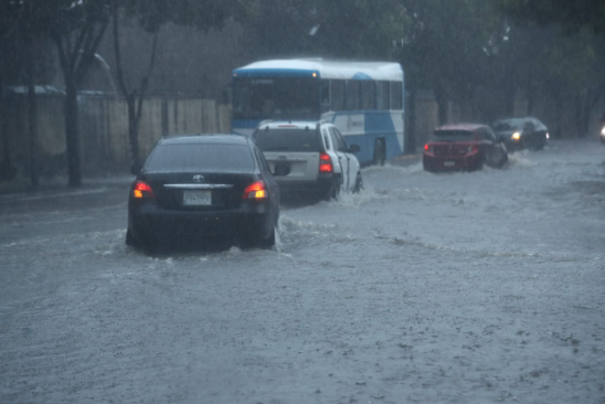
The rainy season in Guatemala began on May 15 with intense downpours, accompanied by electrical activity and hail in various parts of the national territory. In a short time, the rainfall caused the accumulation of water in several points of the capital city and caused several cars to be trapped.
During the afternoon and night of Thursday, May 25, the second most important rain so far this winter, caused traffic complications and floods in some parts of Guatemala City.
The National Institute of Seismology, Volcanology, Meteorology and Hydrology (Insivumeh) has warned that the rainy season will be unstable and with significant climate changes in Guatemala due to the El Niño phenomenon.
The greatest characteristic of this condition is that the season will be marked by strong short-term rainfall, hail and winds. It can bring with it climate variations between high temperatures and rainfall deficits or, conversely, cause excess rainfall on the Caribbean and Pacific slopes, favoring the formation of more severe local storms with erratic movements.
Videos: Sections that flood the most in the capital
In this context, and in order to warn drivers about the most critical points due to accumulation of water in Guatemala City when it rains, Prensa Libre presents a map of the places where it tends to flood the most and cause vehicles to they eventually get stranded.
According to Amílcar Montejo, spokesperson for roads in the Municipality of Guatemala, the Municipal Traffic Police (PMT) has identified at least 10 points, on five important transit routes in the City, that are more severely affected by the accumulation of water products from the torrential rains.
Swallows overflow in 6 minutes or less
“The accumulation of water at these points has to do with, for example, topography issues, the proximity of trees whose roots lift the asphalt and the accumulation of waste, as well as the time that the inlets need to absorb the high levels of water” Montejo said.
According to the road spokesman, when the accumulation of water is recorded, mainly on viaducts and some other points, the swallowers require an average of 4 to 6 minutes to absorb the water and for it to drop to ground level. “On the 13th street viaduct, from zone 11 to zone 12, of Aguilar Batres, for example, when the water reaches a certain level, a red light turns on to tell drivers not to cross and thus prevent them from get stranded,” Montejo said.
“In addition to that, we have also implemented a plan for the removal of solid waste that the water carries towards the inlets at the time of the rain and the closure of the viaducts by the PMT, as long as the water level drops,” added the traffic spokesman.
These are the areas of the capital that are most
America Region News ,Next Big Thing in Public Knowledg


